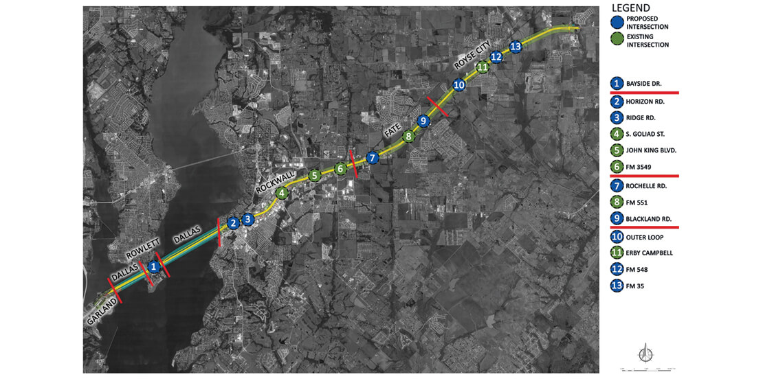
IH 30 Rockwall County Improvements
Client: Texas Department of Transportation – Dallas District
County: Rockwall
State: Texas
Services: Environmental Services, Planning + Landscape Architecture, Transportation Planning
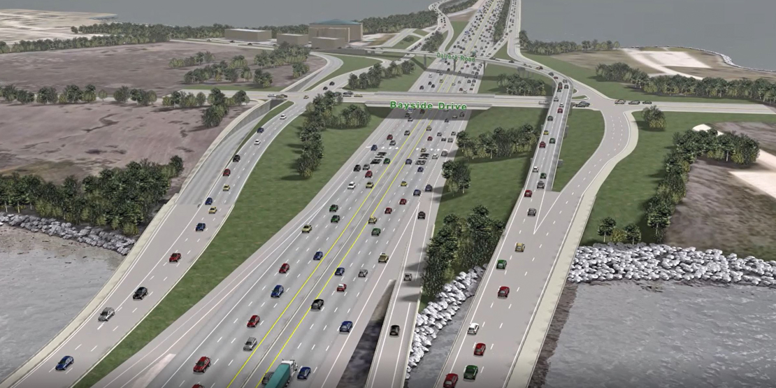
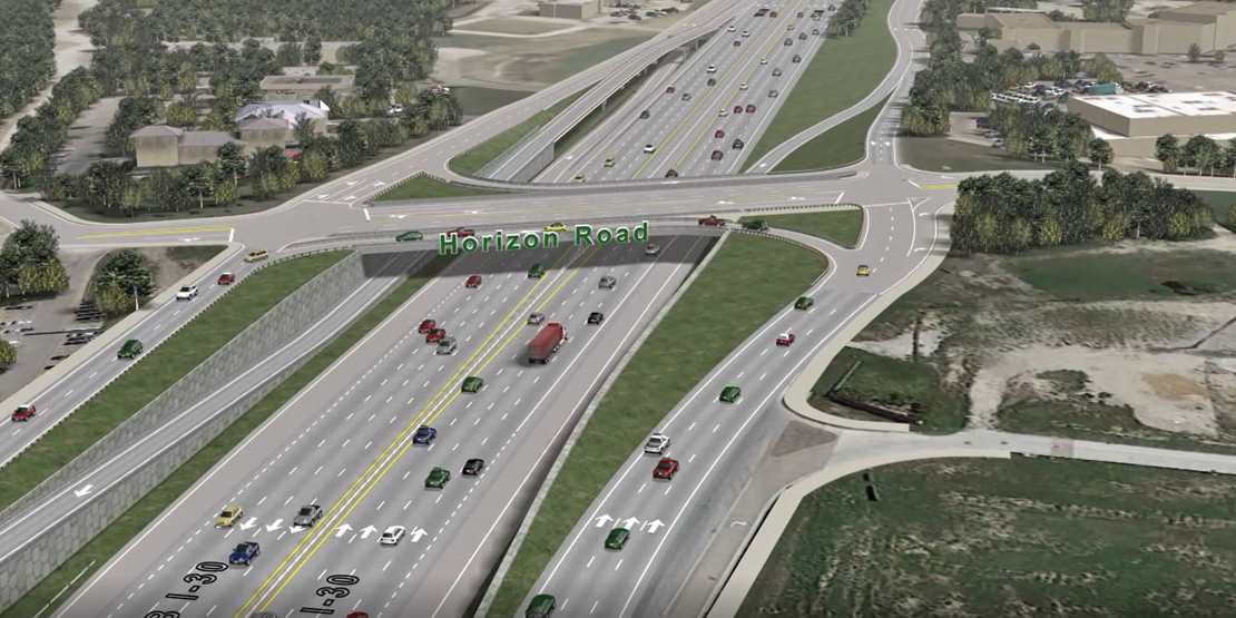
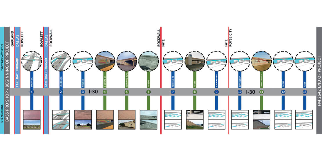
The Texas Department of Transportation (TxDOT) partnered with BGE, Inc. to expand 17 miles of Interstate Highway 30 between Bass Pro Drive to west of FM 2642, through multiple cities in Dallas and Rockwall Counties. The project design included widening and reconstruction of existing 4 to 6 mainlanes to 6-8 mainlanes, continuous 2-3 lane frontage roads in each direction, seven total miles of frontage road bridge structures crossing Lake Ray Hubbard, addition and reconstruction of interchanges, ramp modifications, hydrology and hydraulic modeling and complex TCP. BGE provided professional consulting services, including preliminary engineering, schematic development, environmental studies, aesthetic corridor guidelines and ultimately obtaining Federal Highway Administration (FHWA) design and environmental approval.
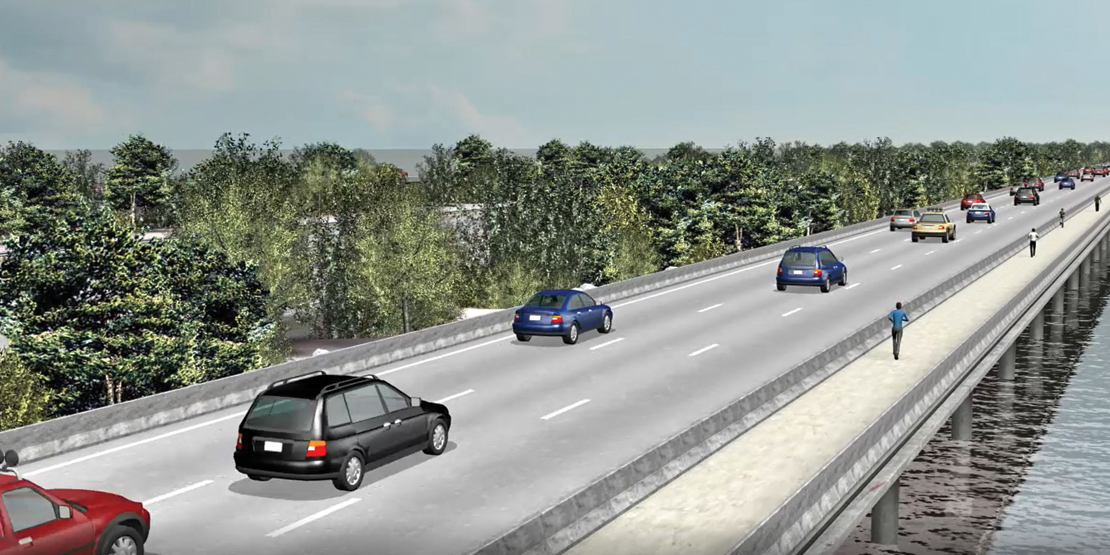
The proposed typical section included retaining walls along mainlanes and urban curb and gutter for frontage roads to absolutely minimize impact outside of the existing 350’ +/- ROW adjacent to dense commercial and residential developments. Approximately 4 miles of the IH 30 mainlanes cross Lake Ray Hubbard on causeways. To minimize impact to the existing mainlanes operation and to minimize water surface impact and valley storage loss to Lake Ray Hubbard, the BGE team’s innovative design solution included sheet piling along the mainlane causeways.
BGE’s experts recommended converting all existing diamond ramps to an X-pattern configuration. This solution would provide critical access to each major interchange while minimizing weaving on the mainlanes. One major challenge of the ramp configuration was the competing interest of local municipalities and major developments owners. Various traffic modeling software and 3D visualizations were used in multiple MAPO’s and stakeholder work sessions to show corridor operations improvements due to the proposed design and ultimately gain consensus among all stakeholders.
The BGE Team worked with the Dallas District to determine logical termini’s for multi-stage construction based on available funding. An innovative, scalable cost estimating tool was utilized, which could be split into various segments per assigned CSJ and translated into the Annual Scope & Estimate Documentation format. TxDOT has since used this first-generation tool to create a statewide estimating template for multiple major projects. The project was seamlessly transitioned to PS&E Design prior to the environmental clearance obtained in March 2019. The first segment of this project is currently under construction.