
Serving. Leading. Solving.™
SURVEYING SERVICES
As part of its in-house capabilities, BGE offers numerous types of surveying services using cutting edge equipment and technology to deliver projects timely and with technical excellence.
Mapping Land With Boundless Capabilities
To ensure a project’s success, BGE is equipped with the latest technology and skillsets to fully utilize industry leading equipment such as robotic total stations, digital levels, aerial drones with photogrammetry and LiDAR capabilities, static and vehicle-mounted LiDAR scanners, tilt compensating RTK GPS, subsurface utility locators, and hydrographic/bathymetric sonar. BGE selects the best tool for each project to meet our client’s needs whether it is data accuracy, cost, and/or schedule.
LAND SURVEYING
PROFESSIONAL LAND SURVEYING
We offer a comprehensive range of surveying services meeting the highest standards of quality and precision essential to project success.
- Topographic surveying
- Boundary surveying
- Route surveying
- Subdivision platting
- Construction staking
- Right-of-way mapping
- Sketch and legal descriptions
- As-Built surveying
- ALTA/NSPS surveying
- Hydrographic surveying
- Control surveying
- GIS asset mapping
- Tree surveying
- Subsurface utility surveying (SUE)
- Volume surveying
- Photogrammetry
- LiDAR mapping
- Bathymetric surveying
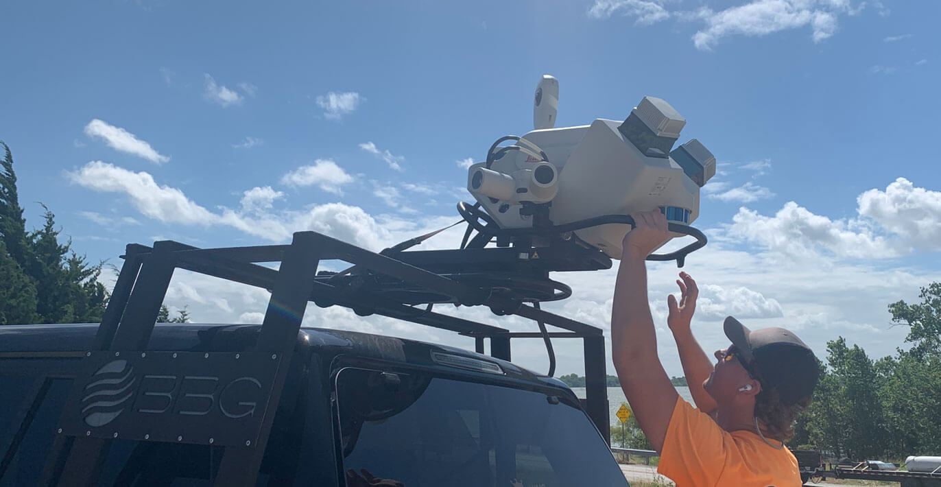
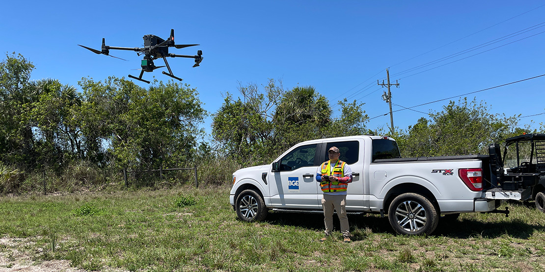
AERIAL drones
Aerial Drones
With unmanned aerial vehicles (UAV), BGE can capture aerial data for any project, including high-resolution orthorectified photogrammetry, LiDAR, and video.
Most commonly used applications:
- Topographic mapping for heavily wooded sites
- Construction monitoring and volume calculations
- Pipeline monitoring
- Concept plans and preliminary site analysis
- Disaster assessments
Transportation Surveying SERVICES
Transportation Surveying services
BGE is precertified with DOT’s in Texas, North Carolina, and Florida, providing surveying services that meet the jurisdictional requirements for both local and state municipalities.
- Precertification in TX, FL, and NC
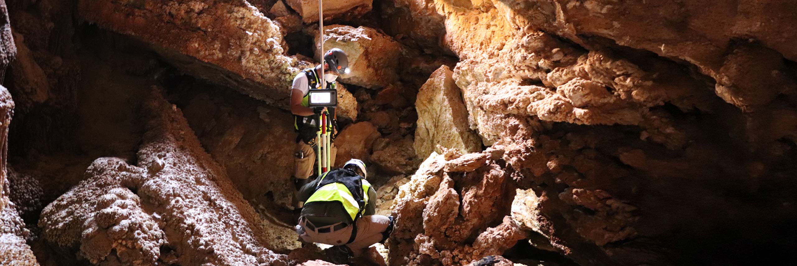
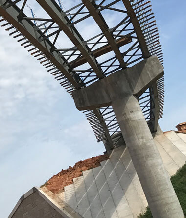
LAKE LAVON
BRIDGE SURVEY
Collaborative innovation
With a boat, a mobile LiDAR unit, and help from our partners, BGE’s multi-regional survey team got creative, and then got busy acquiring data for the Texas Department of Transportation. It was a testament to the power of collaboration.
Projects
PROJECTS WORTH A CLOSER LOOK
In deeper detail, explore some of BGE’s recent surveying projects demonstrating the advantage of expertise, technology, and seamless workflows.
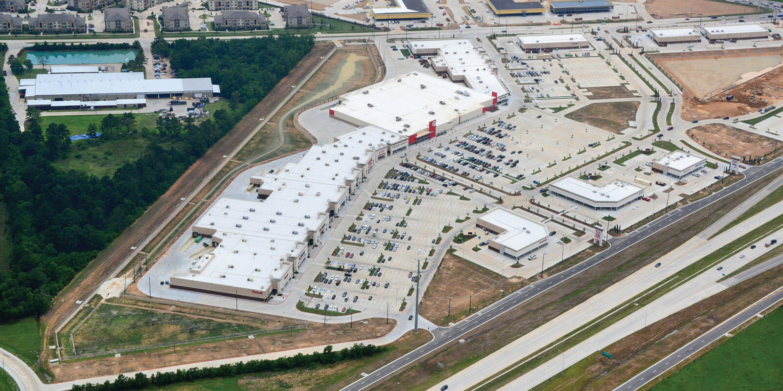
Texas
SH 99 Right-of-way mapping
BGE provided surveying, environmental permitting, drainage design, structural design, public involvement, and construction services for more than 90 miles of the Grand Parkway project.
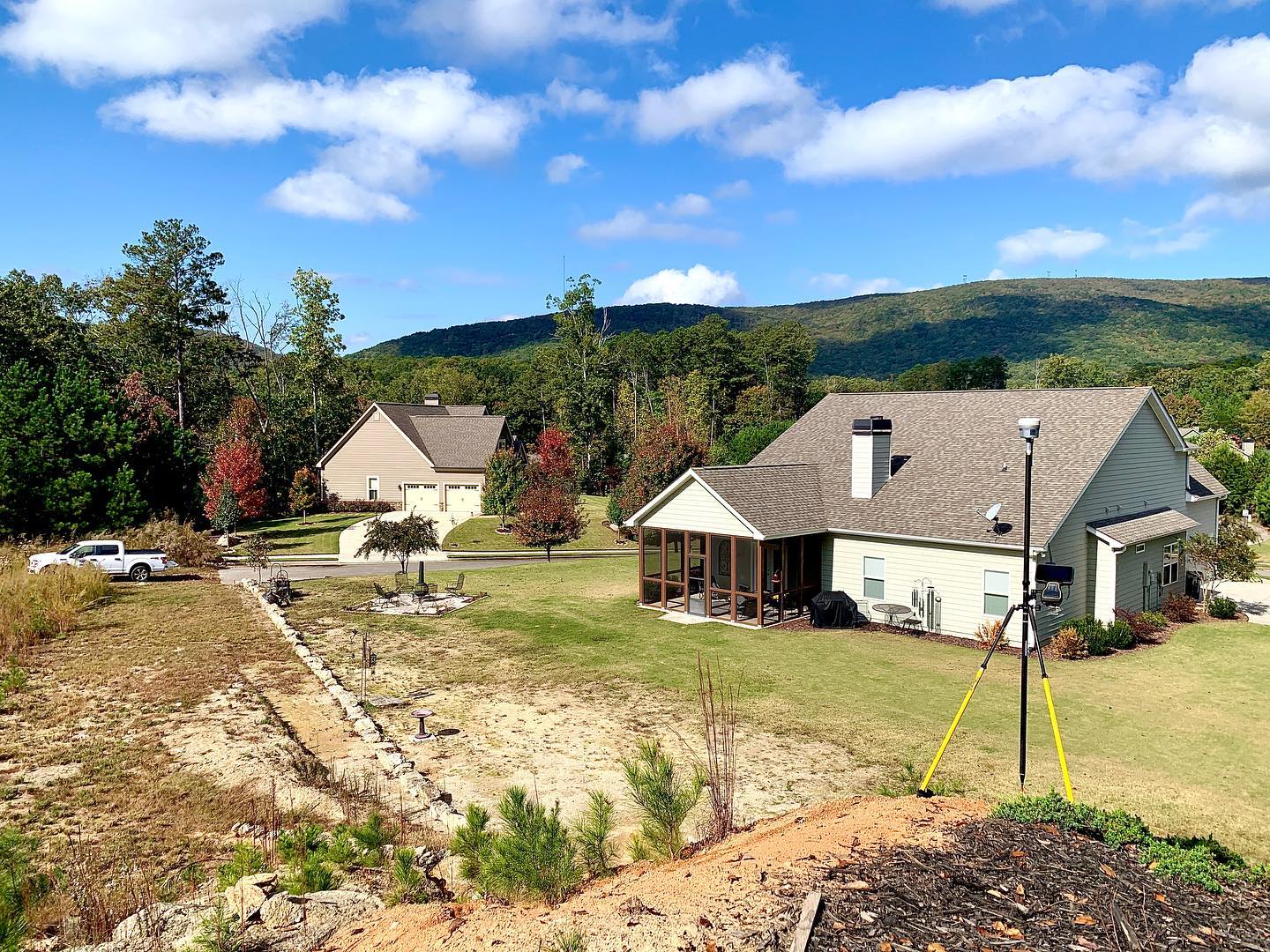
Georgia
Lake Arrowhead
Located approximately 1.5 hours northwest of Atlanta, Georgia, Lake Arrowhead unfolds as a 10-phase master-planned community sprawling across 8,100 acres of picturesque land. BGE provides a comprehensive suite of services here, including engineering, surveying, planning, and construction administration.
Florida
Oak Ridge Ranches (Solaeris) Master Planned Community
As surveying consultant, BGE employed a UAV to collect and merge boundary, topographic, tree, and platting data for this planned MPUD.
A BREADTH OF EXPERTISE
To public and private civil infrastructure projects, BGE brings extensive, multi-disciplinary expertise, reinforced with our unique brand of collaborative firepower.
Land/Site Development
Transportation Systems

Public Works
Surveying
Download Our brochure
By clicking Download you’re confirming that you agree with our Terms and Conditions.
the bge way
TEAM-BASED SUPPORT,
SEAMLESS WORKFLOWS
As with all of our capabilities, our land surveying services are coordinated for an efficient, project workflow with everyone on the same page.
Serving
Improving our communities requires an accurate assessment of our surroundings and challenges.
Leading
Through innovative technology and data-driven insights, we deliver a distinct competitive advantage.
Solving
Collaboration is fundamental to how BGE meets and overcomes the most complex project challenges.
News
Latest News & Insights
Read about the latest at BGE and stay up to date on strategies, trends, and technology transforming our industry.
-
 PeopleRead more: John Harvill, RPLS, Joins BGE as Director of Surveying
John Harvill, RPLS, Joins BGE as Director of Surveying
-

-
 PeopleRead more: Nate Toothaker, PLS, Joins BGE as Project Manager for Surveying
Nate Toothaker, PLS, Joins BGE as Project Manager for Surveying